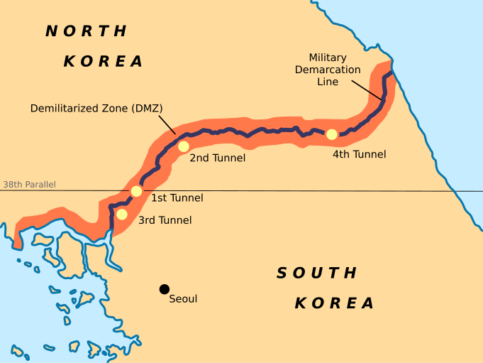
The DMZ
For the start of our summer vacation, a few friends and I booked a tour to go and see the DMZ (Korean Demilitarized Zone) on the northern border of Korea. The tour left from Seoul early one Saturday morning and took us for a two hour bus ride to the JSA (Joint Security Area).

To quote some information from wikipedia: "It was created as part of the Korean Armistice Agreement between North Korea, the People's Republic of China, and the Unitied Nations Command forces in 1953. It is 250 kilometres (160 miles) long, approximately 4 km (2.5 mi) wide and, despite its name, is the most heavily militarized border in the world."
The beginning of the tour started with an in-depth powerpoint presentation about the history of the war between North and South Korea, the agreements and terms of the DMZ, different events that have happened inside since its creation, and the current state of these countries. The presentation was very informative and inspiring to conduct further research upon returning home. It was given by the American soldier that was to be in charge of us for the day: both for our protection and to be a fun and informative tour guide.
We were also required to sign a release form about any dangers that could possibly occur.


Surrounding the buildings and inside (only while the tour group is present in the JSA) are ROK soldiers. They are the ones in the gray shirts and black helmets and are their for the tour groups protection. The center building is the one we are allowed to enter. There are many tables on the inside for the conferences, as well as one that runs perpendicular to the buidling in the center to mark where the border is.

While inside this room, we were allowed to cross the border into North Korean territory. Below you can see the concrete slab that runs between the buildings to mark the border.


On the way to the next point we got to see in the JSA, the bus drove by two particular landmarks that we had learned about in the earlier presentation. The first is a memorial at the location of the axe murder incident that happened in August 1976.


Our final stop inside the JSA was a guard tower which we were allowed to stand at the base of and look into / take pictures of North Korea. In the picture above, you can see the enormous North Korean flag, in the village closest to the border, being picked up a little by the wind. We were not allowed to take any pictures of the South Korean side. (else they threatened to confiscate our cameras and delete everything on them).

After leaving the JSA, we were loaded back into the company tour bus and taken to Dorasan Station. This is the last station on the South Korean border before the tracks that enter North Korea. From December 2007 to December 2008, a frieght train crossed the border from this station every weekday to bring materials and return with goods from a factory inside the North Korean border, but North Korea unexpectedly disallowed the trains entrance into its borders from December 2008.

The next location on the tour was the 3rd tunnel. To quote wikipedia again...
"Since November 15, 1974, the South has discovered that four tunnels crossing the DMZ have been dug by North Korea. This is indicated by the orientation of the blasting lines within each tunnel. Upon their discovery, North Korea claimed that the tunnels were for coal mining; however, no coal has been found in the tunnels, which are dug through granite. Some of the tunnel walls have been painted black to give the appearance of anthracite.
The tunnels are believed to have been planned as a military invasion route by North Korea. Each shaft is large enough to permit the passage of an entire infantry division in one hour, though the tunnels are not wide enough for tanks or vehicles. All the tunnels run in a north-south direction and do not have branches. Following each discovery, engineering within the tunnels has become progressively more advanced. For example, the third tunnel sloped slightly upwards as it progressed southward, to prevent water stagnation. Today, visitors may visit the second, third and fourth tunnels through guided tours."

Our final spot on the tour was a lookout point from which we could see very far into North Korea.

In the distance on the left is Kaesong, the 9th largest city in North Korea.

In the picture below on the left, you can see the distinct line of the border between the north (on the right) and the south (on the left)

Before leaving the DMZ area, we were brought to a gift shop at which you could buy all sorts of tacky souveniers from the occasion. A funny thing that I happened to notice while looking around; they made the South Korean soldier taller than the North Korean soldier even though he isn't standing straight.


To quote some information from wikipedia: "It was created as part of the Korean Armistice Agreement between North Korea, the People's Republic of China, and the Unitied Nations Command forces in 1953. It is 250 kilometres (160 miles) long, approximately 4 km (2.5 mi) wide and, despite its name, is the most heavily militarized border in the world."
The beginning of the tour started with an in-depth powerpoint presentation about the history of the war between North and South Korea, the agreements and terms of the DMZ, different events that have happened inside since its creation, and the current state of these countries. The presentation was very informative and inspiring to conduct further research upon returning home. It was given by the American soldier that was to be in charge of us for the day: both for our protection and to be a fun and informative tour guide.
We were also required to sign a release form about any dangers that could possibly occur.

Following the presetation, they took us in of the the military's buses (in which we were required to travel anywhere we went inside the JSA), to go to the Freedom Building. This is the building on the south side of the border, facing North Korea and the Conference Row. Conference Row, as you can see below is a line of 3 blue buildings in which the two countries hold meetings about the Armistice Agreement and other issues between them,

Surrounding the buildings and inside (only while the tour group is present in the JSA) are ROK soldiers. They are the ones in the gray shirts and black helmets and are their for the tour groups protection. The center building is the one we are allowed to enter. There are many tables on the inside for the conferences, as well as one that runs perpendicular to the buidling in the center to mark where the border is.

While inside this room, we were allowed to cross the border into North Korean territory. Below you can see the concrete slab that runs between the buildings to mark the border.

The tour guide encouraged us to take any pictures we wanted while inside the building, so most people got pictures of themselves standing next to a ROK soldier while inside the North Korean border.
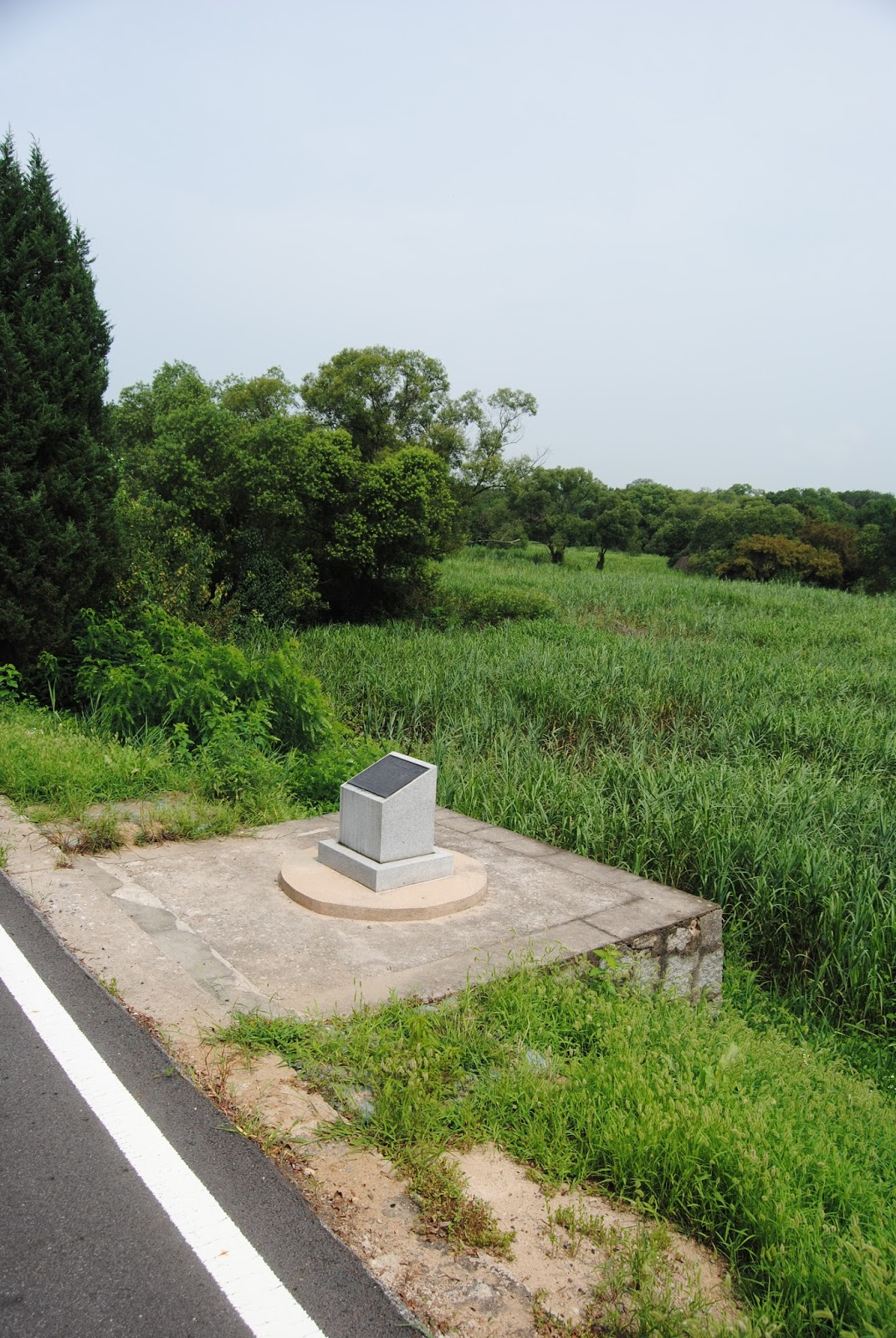

On the way to the next point we got to see in the JSA, the bus drove by two particular landmarks that we had learned about in the earlier presentation. The first is a memorial at the location of the axe murder incident that happened in August 1976.

The second was the Bridge of No Return. This bridge was used for the exchanging of prisoners at the end of the Korean War in 1953. Many of the prisoners held in South Korea did not wish to return to North Korea, so they were brought to the bridge and given a choice. They could stay in captivity in this country, or cross back into North Korea on which terms they would never be allowed to return.

Our final stop inside the JSA was a guard tower which we were allowed to stand at the base of and look into / take pictures of North Korea. In the picture above, you can see the enormous North Korean flag, in the village closest to the border, being picked up a little by the wind. We were not allowed to take any pictures of the South Korean side. (else they threatened to confiscate our cameras and delete everything on them).

After leaving the JSA, we were loaded back into the company tour bus and taken to Dorasan Station. This is the last station on the South Korean border before the tracks that enter North Korea. From December 2007 to December 2008, a frieght train crossed the border from this station every weekday to bring materials and return with goods from a factory inside the North Korean border, but North Korea unexpectedly disallowed the trains entrance into its borders from December 2008.

The next location on the tour was the 3rd tunnel. To quote wikipedia again...
"Since November 15, 1974, the South has discovered that four tunnels crossing the DMZ have been dug by North Korea. This is indicated by the orientation of the blasting lines within each tunnel. Upon their discovery, North Korea claimed that the tunnels were for coal mining; however, no coal has been found in the tunnels, which are dug through granite. Some of the tunnel walls have been painted black to give the appearance of anthracite.
The tunnels are believed to have been planned as a military invasion route by North Korea. Each shaft is large enough to permit the passage of an entire infantry division in one hour, though the tunnels are not wide enough for tanks or vehicles. All the tunnels run in a north-south direction and do not have branches. Following each discovery, engineering within the tunnels has become progressively more advanced. For example, the third tunnel sloped slightly upwards as it progressed southward, to prevent water stagnation. Today, visitors may visit the second, third and fourth tunnels through guided tours."

Our final spot on the tour was a lookout point from which we could see very far into North Korea.

In the distance on the left is Kaesong, the 9th largest city in North Korea.

In the picture below on the left, you can see the distinct line of the border between the north (on the right) and the south (on the left)

Before leaving the DMZ area, we were brought to a gift shop at which you could buy all sorts of tacky souveniers from the occasion. A funny thing that I happened to notice while looking around; they made the South Korean soldier taller than the North Korean soldier even though he isn't standing straight.

I encourage you if you're interested to please read up more about the DMZ and the situation between North and South Korea. It is all but over with. My tour with my friends happened on August 8th, 2015. And we fould out a few weeks later of 2 incidents that happed over the course of the month:
- August 9, 2015: Two South Korean soldiers were wounded after stepping on landmines that had allegedly been laid on the southern side of the DMZ by North Korean forces next to a ROK guard post.
- August 20, 2015: North Korea fired one 14.5 mm anti-craft shell at 3:52 p.m. (0625 GMT)
- August 20, 2015: North Korea fired one 14.5 mm anti-aircraft shell at 3:52 p.m. (0652 GMT) in response to the renewed use of propaganda being broadcast by South Korean loudspeakers. South Korea responded by firing multiple shells from a 155 mm direct fire weapon at 5:04 p.m
.JPG)
.JPG)
.JPG)
Comments
Post a Comment